Climbing Mt Fishtail
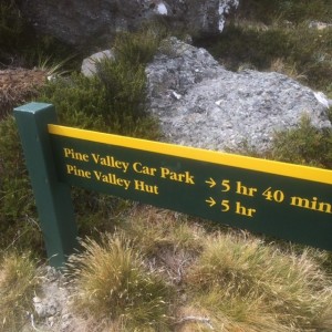
After a relaxing sleep in and sorting some gear, we packed our bags and headed to Marlborough. It was a two hour drive from Nelson over to Marlborough and up North Bank Road on the banks of the Wairau River, turning into Pine Valley and driving to the road end.
We commenced the walk up the river on the track on the true right, over the swing bridge and up to the site of the old Pine Valley Hut. It took all of twenty minutes. From there the track was rougher and more back country. After another twenty odd minutes we crossed the creek and commenced to climb. Climb up and up.
Starting at 220m above sea level by the time we got to the creek crossing we had only climbed 100m. Over the next 3.5km we climbed over 900m. It was relentless. It felt like doing a big set of squats.
Travelling through beach forest, wasps are a common problem but not today for us as they all appeared drunk. Literally falling to the ground all around us each time we walked past a beech tree.
We made a deal to stop for lunch once we reached 1,000m unless we found somewhere amazing to stop beforehand. As I watched the altimeter it climbed up above 980m, 985m, 990m – getting close to lunch. I looked up and saw that we were about to reach a wee peak with a descent down the other side. 995m, 996m, 997m, 998m, 999m and then we descended. Damn lunch will have to be a little later.
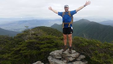
By the time we got back up to 1,000m we had got into a bit of a rhythm and although I was hungry, Rach was charging on and I didn’t want to break the progress we were making. We eventually burst out onto a nice rocky outcrop with an amazing view of the surrounding hills and across the Wairau Valley.
After a quick bite to eat we continued onwards and upwards and finally we moved off the spur line just after we reached the edge of the bushline. The track traversed a rocky scree slope and we spotted a few wild goats as we made our way across to the hut.
Fishtail Hut is a sparse hut with four bunks and nothing much else. We paused here briefly to write our intentions in the hut log, as from this point on we were going off track to the summit.
After topping up with water we commenced the climb to the summit by clambering up the scree slope. We hit the saddle between the two peaks after only ten minutes. From there we turned right and climbed up into the clouds. Although visibility was limited it wasn’t restrictive and we climbed up to the summit at 1641m. Up there it was cold and the wind was very biting. There was a wee geocach barely hidden at the summit, so we grabbed it and clambered down a little bit and had an Easter egg, as we added our details to the geocach. We left a couple of miniature Easter eggs for some lucky climber. We didn’t hang around too long so as not to get too cold. It didn’t take long to get down out of the wind and soon we found ourselves back on the saddle. Down the scree slope was a challenge back to the hut. A quick top up with water and updating the hut log book and we got on the way again.
 The descent back into the bush was straight forward. But by the time we got down to 1,200m the climb up was starting to take it’s toll. The eccentric loading of the quads had accumulated and climbing down a 35% gradient very challenging. But by the time we got back to the creek crossing it was plain sailing back to the vehicle. Just prior to getting back to the clearing for the old Pine Valley Hut, we came across a hunter with a bow and arrow hunting ‘goats’!!! He appeared stoned and was drinking. We walked very briskly to avoid finding out what an arrow in the back from 50m feels like!!
Having recently walked the true right on a number of trips we returned back to the vehicle through Mill Flat and as our feet were already wet I wasn’t worried about getting them wet again with the stream crossing at the end, instead of crossing with the swing bridge.
I should have assessed the crossing point closer when we first arrived. It certainly wasn’t suitable for cross. But a quick bush bash and assessing a calmer area up stream, we crossed safely and returned back to the vehicle.
Details of what lead into this adventure can be found here.
Summary of today’s hike.
Max altitude: 1641m
Starting altitude: 220 m
Distance: 20.1 km
Altitude gained: 1762 m
Duration of hike: 7 hr 17 min

2 Replies to “#4daysofadventure – Day One”